Loading
Archive
Projects
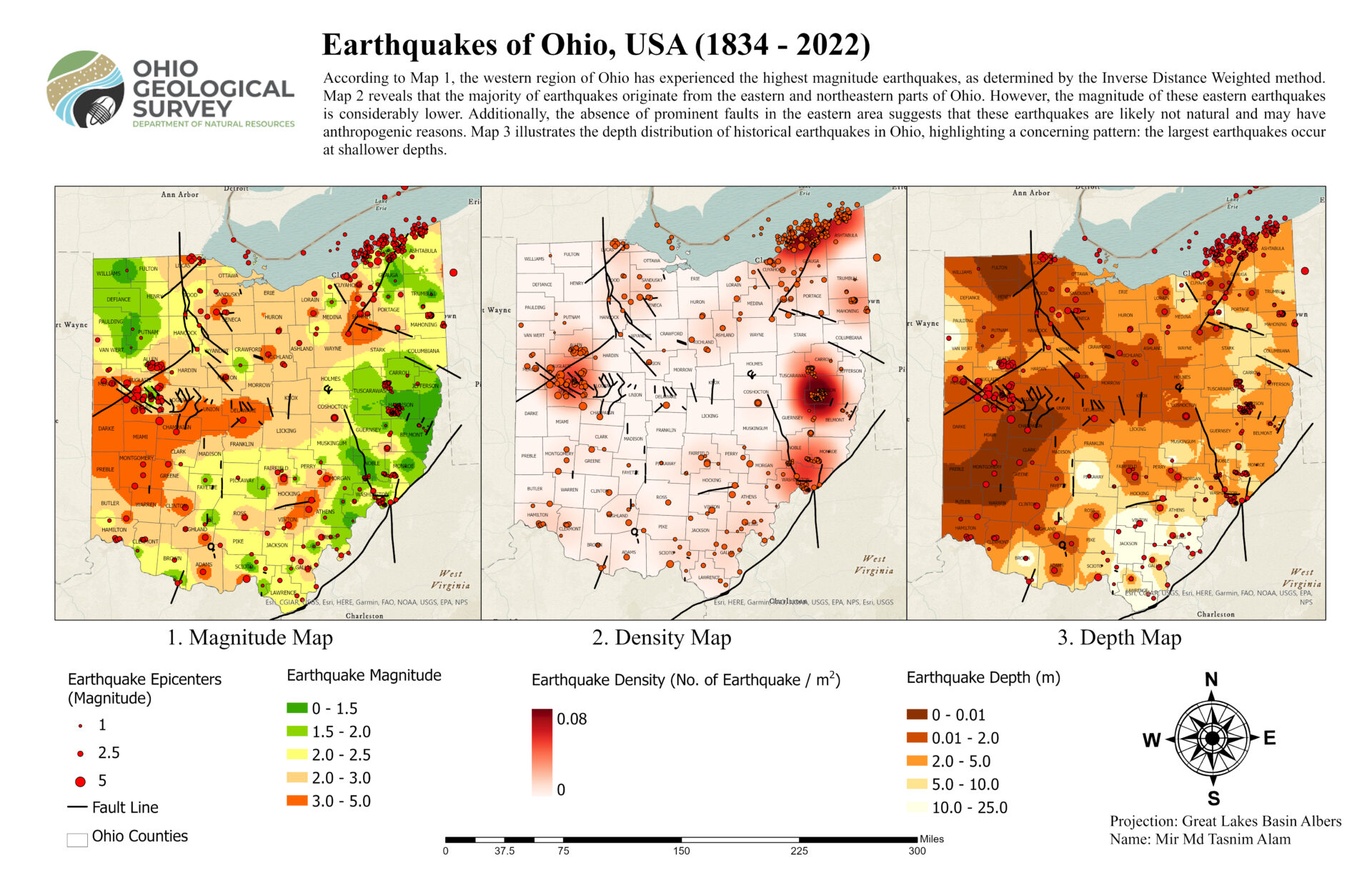
Ohio Earthquakes
One of the projects that I did while working at the Ohio Geological Survey, a division of ODNR.
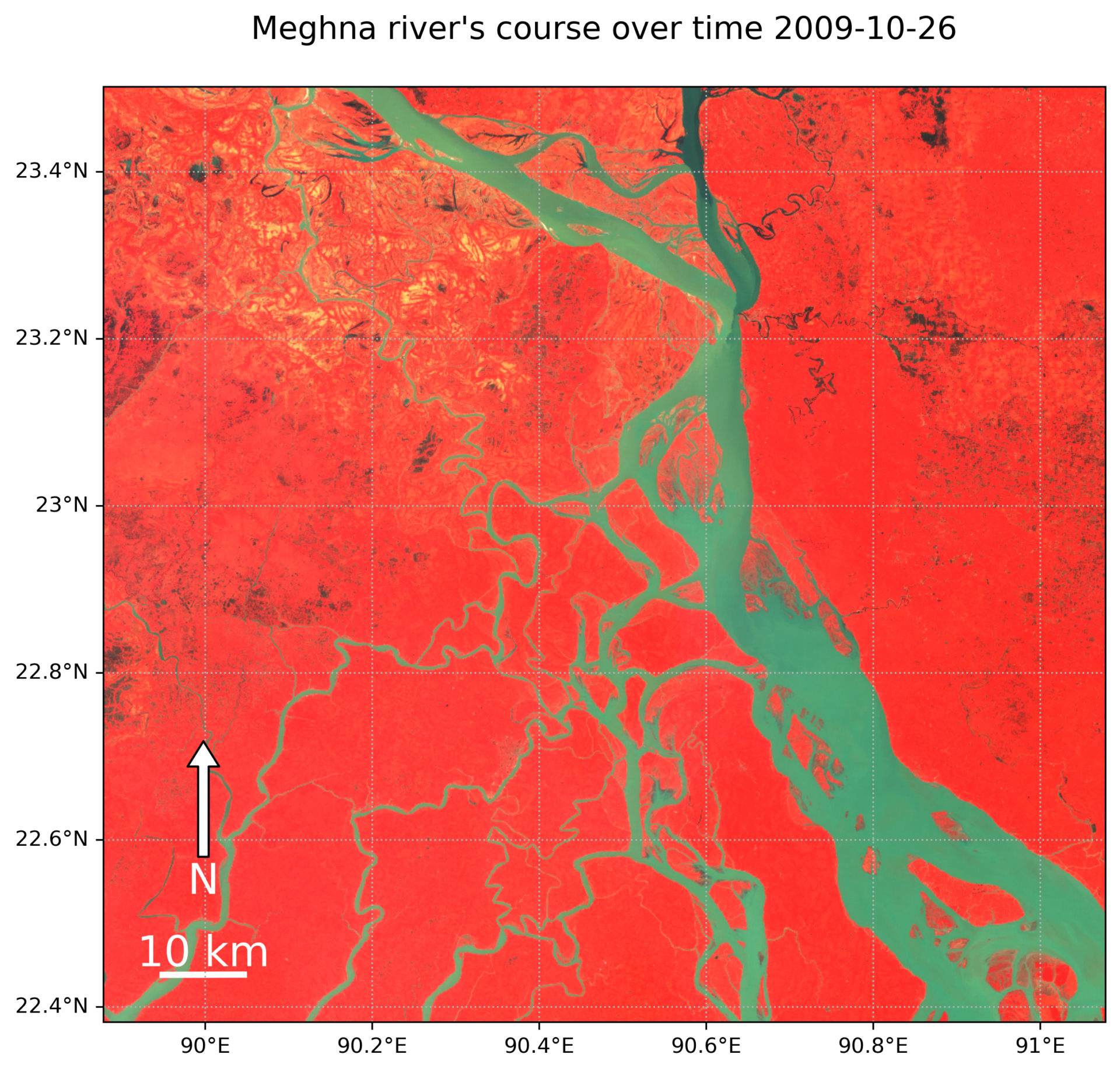
Watching the Change of Meghna in Bangladesh: 1988 to 2011
I made this animation using only Landsat 5 data because Landsat 7 had strange stripe-like patterns that didn’t look good. I put together this cool animation using Python and the Geemap library, which connects to Google Earth Engine to make it all happen. Want to do more cool stuffs? Let’s collaborate! info@tasnimalam.com

3D Population Map of India
If you want the full version of this cool picture, send me an email. info@tasnimalam.com
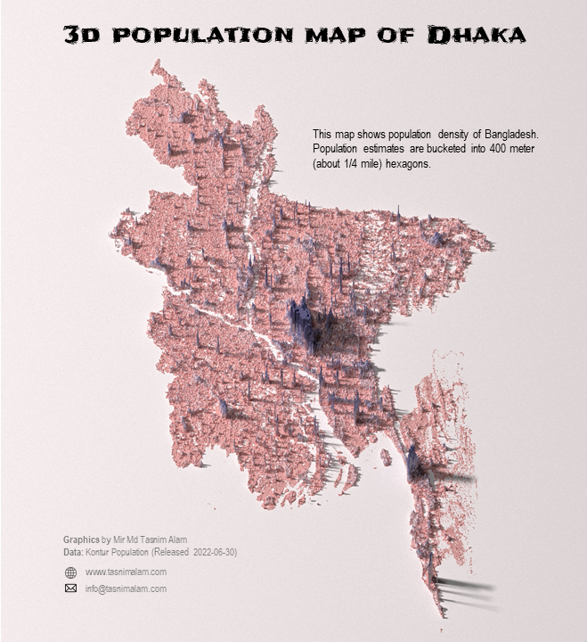
3D Population Map of Dhaka
I did all the coding in R and whipped up this cool 3D map using the awesome rayshader package. Stay tuned for more 3D map adventures with different data in the pipeline! The photo quality has been compressed a lot after adding all the texts. Let me know if you want the full version of the image. Contact info is.. Read more


+
+